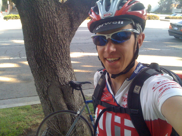
SF to LA by bicycle
Back in September of 2010 I did a quick touring trip from Burlingame in the San Francisco Bay Area to Los Angeles. Below is a write-up of the ride.
Day 1
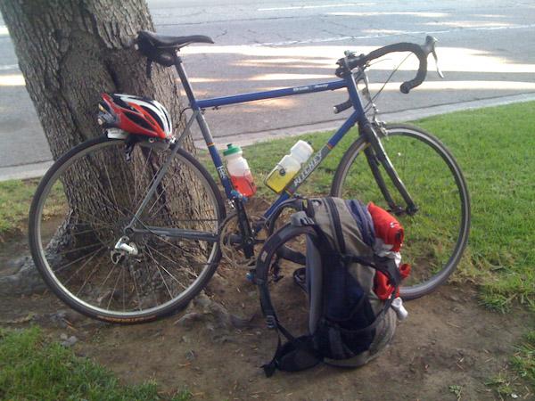
It was the night before the ride and I there were a few too many things still on my to-do list. Install the bike computer, get water bottles ready with sports drink, check the bike one last time, sign up for the CFA level 3 exam, get clothes and gear ready for the morning. I worked through it all, set the alarm for 6:00am, and hit the sack a little later than I would have liked. Like a child on Christmas eve, I awoke multiple times during the night in anticipation. Soon enough it was time to get started. Mom and Dad were kind enough to wake up early with me. Mom whipped up a delicious omelet and the three of us chatted for a bit while we waited for there to be a little more light out. The sky was crystal clear. I cruised through an empty downtown Burlingame and started climbing through the hills of Hillsborough and San Mateo. I climbed up and over the ridge on Highway 92. The extra ~20 pounds of weight on my back was definitely noticeable on the climbs, but I tried to pace myself knowing that there would be long days ahead. Clear skies quickly turned into overcast and then fog as I descending down into Half Moon Bay. The cool, cloudy weather was not the best for sightseeing but was good for riding.
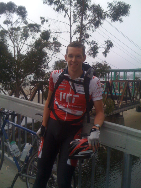
The ride from Half Moon Bay south to Santa Cruz is a pleasant affair, but the constant rolling hills (“rollers”) were a bit bigger than I remembered. The area is known for its crops and is known for producing the world’s largest pumpkins. The smell of pumpkin wafted through the air as I passed the freshly-picked fields. Artichokes were also bountiful in many of the surrounding areas. I met up with my good friend Melanie for a burrito break in Santa Cruz. After lunch I cruised along the coast through town and even saw an otter playing in the water. After departing Santa Cruz and Capitola, the bike route winds southward. In some places it is nice and serene. In other spots you are left to grind away on the shoulder of a busy highway. Making it to Monterey felt like a real accomplishment, about 100 miles down. On any other day for me, this would signal the end of a long ride. Not so today. The ensuing climb over the peninsula to Carmel was a good reminder of the fitness that my legs lacked. The burning quads were quickly forgotten after taking a quick break in lovely Carmel and moving on to the highlight of the route, Big Sur.
The world transforms as you venture south of Carmel on Highway 1. The mountains grow larger and creep closer and closer to the turbulent blue waters. Before you know it, you are on one on the world’s most beautiful stretches of road, perched high above California’s rugged coast. The tailwind kicked in to high gear, and the final 30 miles felt downright fun, even though I already had ~120 miles in the saddle. Just as the sun was getting lower on the horizon, I made it to my home for the night, Julia Pfeiffer Burns State Park. One of the America’s greatest parks and campground, it was well worth $5 for a “hike and bike” camping spot. My legs felt surprisingly good getting off the bike, especially considering that the 146 mile journey was my longest ride ever. I met a British girl riding from LA to SF who was also staying at the bike camp area. She was riding about 14 miles per day, so I received a funny look when I mentioned that I was doing the route in 3 days – requiring more than 150 miles per day. We were on two very different trips. It might be nice to take such a leisurely pace… someday. I took a hot shower and enjoyed a hearty meal at the restaurant. I lit a campfire for a few hours and then went to bed, ready for another day of riding. I went to sleep a little anxious, not sure how my body would respond on day two.
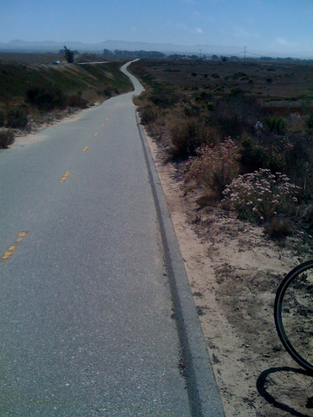
Bike path near Monterey, CA 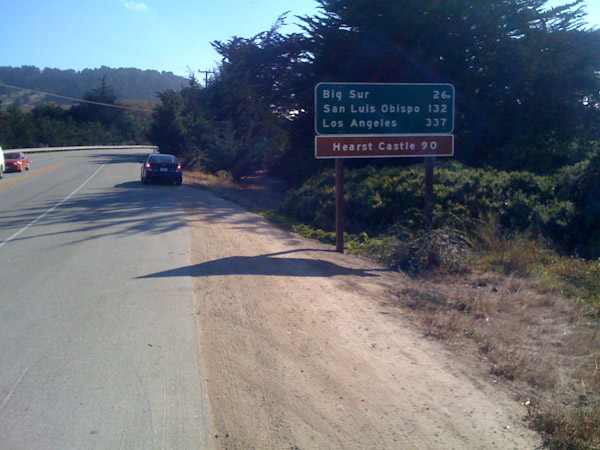
Start of the Big Sur Coastline 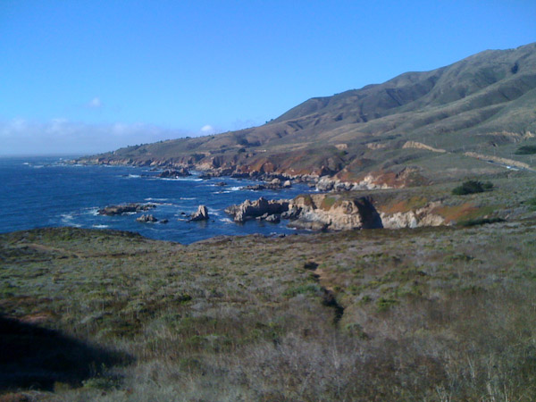
Big Sur 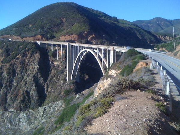
Bixby Bridge
Day 1 Summary:
- 146 miles
- 9 hours 17 minutes (riding time)
- 15.7 mph
Day 2
I woke up to sunny skies and moderate temperatures, which is quite a treat when it comes to camping on California’s central coast. Breakfast consisted of some stale bagels and a banana I picked up the day before. Breaking down camp was a simple event: fold up the ground tarp and stuff the sleeping bag into a sack. No fancy-schmancy pads, tents, stoves, or cookware to worry about. Well, maybe a pad would have been nice.
The ride started out with a fairly long climb, not my preferred way to warm up in the morning. I struggled to the top, but then enjoyed the wild ride up and down the coastal mountains. There were a number of hard uphill sections, but the scenery was so stunning that it all went by fairly quickly. It was early in the morning, so at times I felt like I had all of Highway 1 to myself. Unfortunately, my average speed was pretty low and I was a bit worried about how much progress I would be able to make on day two.
Fortunately, the road settles out after passing Ragged Point. To help out even more, the tailwinds kicked up and gave me a nice boost in speed. I spent the middle of the day cruising along the coast from town to town. San Simeon: saw the elephant seals. Cambria. Morro Bay. San Luis Obispo. Pismo Beach. Grover Park. Oceano. Then I started heading inland and into farming country. Guadalupe. Orcutt.
It was getting later in the day, and I knew that I still had a hard stretch to get from Orcutt to Lompoc. I stopped at a gas station to rest and get refreshed. The road to Lompoc wasn’t so bad, but then the clouds started to encroach, the headwinds picked up, and the grade grew steeper. I could see the highway in the distance wind up the mountain, and I tried to pace myself. I slogged up the climb at minimum speed given the gears I had on the bike. Each bend in the road seemed to reveal another stretch of painful climbing. But let’s be honest here, this is coastal California, not the Sierras, not the Swiss Alps. The “long” climb of ~2 miles was nothing compared to the mountain passes, but somehow the fatigue in my legs transformed this bunny hill into a hors categorie (French cycling-speak for “beyond rating”) ascent. I needed to suck it up and keep moving. Eventually the interminable climb ended as I reached the entrance to Vandenberg Air Force Base. A few more rolling miles and I entered the town of Lompoc.
At the southern edge of Lompoc I found a Subway that would serve as my last chance for a warm meal before finding a camping spot. I scarfed down a 12 inch sandwich, downed a coke, and picked up another 6 inch sandwich and a handful of cookies for the road. The only other two patrons in the restaurant, a mother and her daughter, stared at me like I had just beamed down from outer space. It was nice being indoors as the clouds grew thicker and dusk approached, but I knew that I had to get out of town and find a good camping spot before dark. There were no official campgrounds near Lompoc, so tonight I would be “stealth camping.” The town ends immediately upon turning south onto San Julian Rd. I had a bit of a second wind (or maybe it was my eight or ninth wind at this point) as I got on San Julian Rd. The terrain was rolling and scrubby, but the road itself was along the flat valley floor. I rolled along as dusk settled, keeping an eye out for a good place to call home for the night. Nothing felt quite right: too visible from the road, too steep, too rocky, too many bushes. But this was not the time to play Goldilocks. However, in some ways I was happy to keep riding along, as each mile covered today was a mile that I didn’t have to complete tomorrow. Even with 160+ miles in my legs, I thought to myself that it would be nice to have a good light so that I could right through the dark.
Eventually sanity prevailed, and I spotted a dry creek bed that was clear of brush and barely visible from the road. I waited for a moment with no traffic coming or going in either direction and darted down the embankment to scout out the location. The stark-white, dry silt in the creek bed was relatively soft and pliable. This would suffice for the night. I checked on my bike computer to review the totals for the day. 168 miles, another personal record. I hunkered down early for the night, watching the clouds blow overhead at impressive speed. Thank goodness the winds blew in my favor for most of the day. I would not have been able to make it otherwise.
I was stirred during the night for various reasons. Periods of mist would come and go. I hoped that it wouldn’t turn into full-on rain, and fortunately the weather stayed mild. Lumps in the ground would poke my sore legs, back, and arms in just the wrong way. Animals would regularly chatter and chirp, it turns out I had encroached upon a colony of moles. I’ve heard stories of rodents eating through rubber tires and cork handlebar tape. Fortunately these critters were not interested in me or my bike. As the night went on, the clouds departed. It was a full moon, and the cool moonlight lit the sky and reflected iridescently off the white silt.
Day 2 Summary:
- 168 miles
- 10 hours 8 minutes (riding)
- 16.6 mph
Day 3
At 6:00am, my alarm reminded me that dawn was approaching. It was time to put on the headlamp, break camp, and get on the road. I reset my bike computer, planning to put in another 140+ miles for the penultimate day. It only took a pedal stroke or two to realize and say to myself “hmm, my legs are pretty tired.”
The rolling terrain that felt great last night now bogged me down. The road looked flat, but I was moving at 12mph, far too slow given the conditions. This was not the best start to the day. As I meandered on, the sun began to peak over the hills and cast a warm glow on the surrounding farmland. It was a spectacular morning. The natural beauty helped distract me from the slow toiling along Highway 1. Around one bend I noticed the road continuing straight for quite a distance and then disappearing, suggesting the top of a climb. I reached to top of the road and checked the elevation on my iPhone. It read ~1,000 feet and I knew that Lompoc rests at only ~100 feet. This made me feel a little better about my sluggish legs, I had actually been doing much more climbing that I thought across the terrain. From the top of the hill it was a fast and fun descent all the way back to the coast at Gaviota State Park. Gaviota’s rail bridge, framed perfectly with the Pacific glimmering in the morning sun, was a refreshing sight.
I knew the landmarks from here all the way back home. I pedaled from landmark to landmark, breaking the ride into bite-size chunks. Refugio State Beach. El Capitan State Beach. Goleta. Santa Barbara. Had coffee and some baked goods at a nice place near the beach. Summerland. Carpinteria. Some lovely riding along the coast here that is unfortunately spoiled by riding alongside the noisy freeway traffic. Faria Beach. Met two guys from Reno riding from Monterey to LA. Ventura. Oxnard. Ahh, now this is all starting to get really familiar. Oxnard is easily reachable from home as a ~100 mile ride roundtrip. I stopped in Oxnard to refill my water bottles. Some rather boastful guy started chatting with me. He was doing pretty much the same ride as me, but had started two days earlier and was staying in hotels. I think he would have been better off boasting to someone else, but we shared some good stories about the route. He had a similar experience on the hill before Lompoc. Back on the road. At this point I knew I was close to home, but also knew the traffic was about to get heavier and I needed to stay focused and safe. It is so easy to get distracted when fatigued. One little wobble of the handlebars can dump you on the tarmac or pitch you in front of a semi-trailer. In the Tour de France, you can crash in the last two kilometers and still receive the same finishing time as the group your were in, but no such niceties exist in real life.
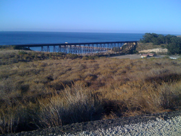
Gaviota State Park 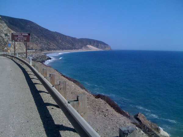
Ventura Coastline 
Malibu
The tailwinds were blowing persistently again. At times it turned into a crosswind and then a quartering-headwind. I passed Big Rock, a natural point of separation between the agricultural and mountainous portions of southern Ventura County. It is also a popular turnaround spot for cyclists coming from the LA basin. Highway 1 reduces to one lane of traffic in each direction and meanders along the coast here for several miles, it is quite nice. It was an unusually clear day and the coastline was particularly brilliant… or maybe it is just that delirium was setting in. More landmarks to tick off. Leo Carrillo State Beach. Trancas Market in Malibu. Zuma Beach. Pepperdine. Topanga Canyon Blvd. Sunset Blvd. Santa Monica. Sparing expediency, I rode through Santa Monica on the bike path to minimize interactions with cars blazing past at 50+ mph only feet away. From there it was a quick ride through always-crazy Venice Beach, artsy Abbott Kinney, and gritty Venice Blvd. Home at last it was a relief (literally!) to get off the saddle, but there was a touch of sadness knowing that the adventure was over. I wonder what is next…
Day 3:
- 145.5 miles
- 8 hours 46 minutes (riding)
- 16.6mph
Total:
- 459.5 miles
- 28 hours 11 minutes (riding)
- 16.3 mph
Thanks for reading! Thanks to all those that made the trip possible, especially my parents for the ride to the Bay Area and my wife for putting up with my silly ideas.